Walking route: L'Anse de Fouras - 3 mi
in Fouras
4.4
km
1h
Easy
-
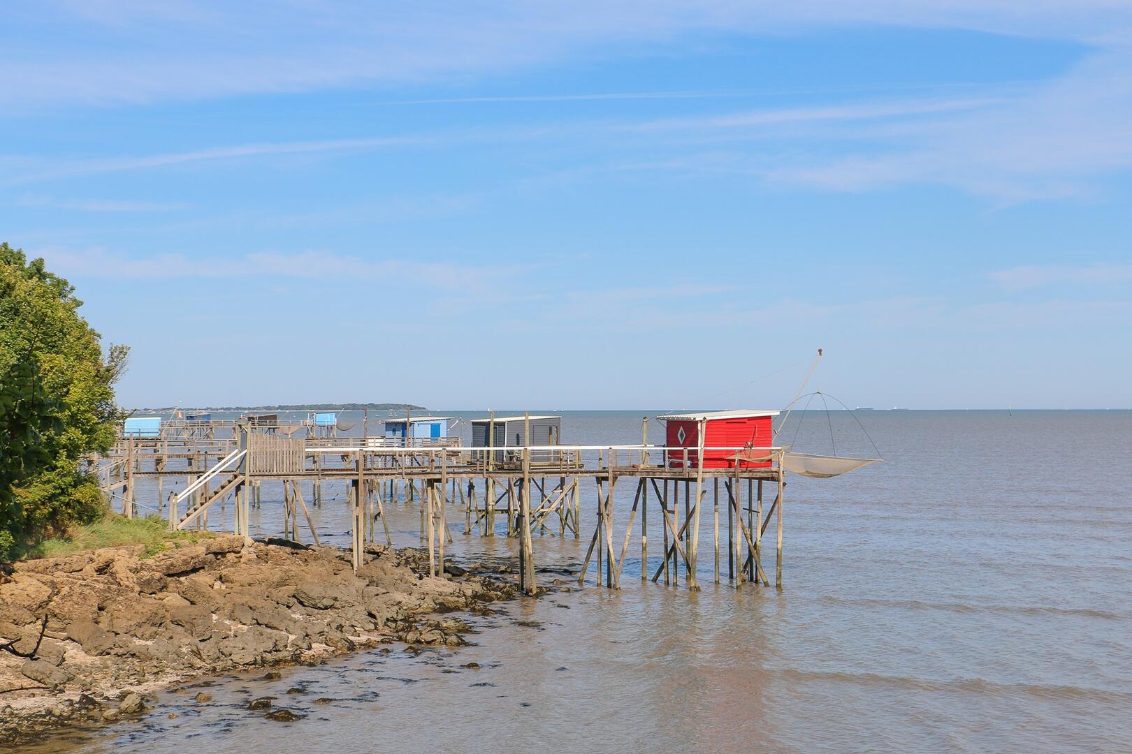
Exploring the north shore of Fouras is a real feast for the eyes, with its succession of fishing huts and views over the national nature reserve of the Bay and Marshes of Yves. Weather permitting, you can see as far as the port of La Pallice and the Île de Ré.
-
Along the way, you’ll see:
- Mudflats, fish, square-mesh nets: In Yves Bay, you can see the square-mesh nets, a reminder of a traditional local fishing method that uses a large net with square mesh to catch fish and shellfish (prawns, crabs, etc.) that move with the tides. This vast expanse of mudflat, with a very flat, shallow seabed, is exposed for kilometres at low tide. It is the estuaries of the Garonne and the Charente that carry sediments of varying fineness.
Microphytobenthos –...Along the way, you’ll see:
- Mudflats, fish, square-mesh nets: In Yves Bay, you can see the square-mesh nets, a reminder of a traditional local fishing method that uses a large net with square mesh to catch fish and shellfish (prawns, crabs, etc.) that move with the tides. This vast expanse of mudflat, with a very flat, shallow seabed, is exposed for kilometres at low tide. It is the estuaries of the Garonne and the Charente that carry sediments of varying fineness.
Microphytobenthos – microscopic algae settled on the seabed – covers much of the mudflat’s surface and forms the basis of the food chain,
providing food for the oysters and mussels farmed in the bay in particular. It also provides food for clams, which are highly prized by both professional and amateur fishermen, as well as other shellfish, crustaceans and marine worms, all of which serve as ideal prey for fish and coastal waterbirds.
- Red Knot: Like all waders, this is a migratory species that can be observed from September to March on open coastlines with sandy or muddy banks rich in invertebrate prey. In spring and summer, it breeds in the High Arctic tundra. On the mudflats of Yves Bay, the LPO counted 2,000 in January 2025, representing over 6 per cent of the national population and making Yves Bay a site of national importance for the species.
- Difference in height
- 45.36 m
-
-
Documentation
- GPX / KML files allow you to export the trail of your hike to your GPS (or other navigation tool)
-
- 45 meters of difference in height
-
- Start altitude : 4 m
- End altitude : 4 m
- Maximum altitude : 13 m
- Minimum altitude : 1 m
- Total positive elevation : 45 m
- Total negative elevation : -45 m
- Max positive elevation : 3 m
- Min positive elevation : -8 m