Walking route: Tour of the downtown and the marshes 3.7 mi
in Beaugeay
6.6
km
1h 40min
Easy
-
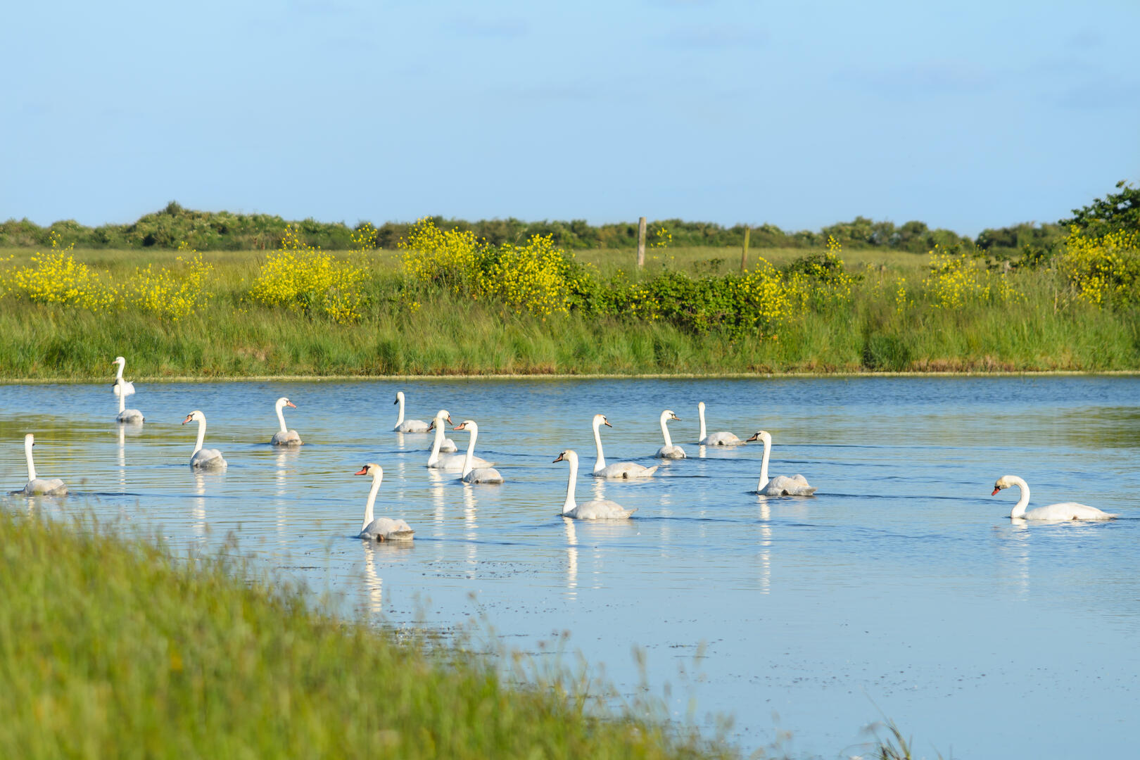
Discover the local flora and fauna as you explore the marshes and canals along the route. This area is ideal for nesting and as a stopover for migratory birds. You might be lucky enough to spot them at the right time of year!
-
Along the way, you will pass through:
- The Brouage Marshes: A Natura 2000-designated area, this is a delicate mosaic of wet meadows interwoven with a dense network of canals and water-filled ditches, fringed with reed beds. It is one of the richest and most iconic wetlands in France. Its biodiversity is exceptional.
- The Charene-Seudre Canal: A major ecological corridor, it is the main artery of the Marais de Brouage and links the Charente to the Seudre, supplying fresh water to all the...Along the way, you will pass through:
- The Brouage Marshes: A Natura 2000-designated area, this is a delicate mosaic of wet meadows interwoven with a dense network of canals and water-filled ditches, fringed with reed beds. It is one of the richest and most iconic wetlands in France. Its biodiversity is exceptional.
- The Charene-Seudre Canal: A major ecological corridor, it is the main artery of the Marais de Brouage and links the Charente to the Seudre, supplying fresh water to all the marshes it crosses. Commissioned in 1862, it stretches for 27 km. Unnavigable since 1926, it belongs to the Public Waterways Authority.
You may spot:
- The little bittern: The stockiest of the herons, this migratory bird arrives in the marshes in April. During the breeding season, it frequents the edges of freshwater bodies, particularly areas with dense riparian vegetation.
- Difference in height
- 18.93 m
-
-
Documentation
- GPX / KML files allow you to export the trail of your hike to your GPS (or other navigation tool)
-
- See all reviews
- Points of interest
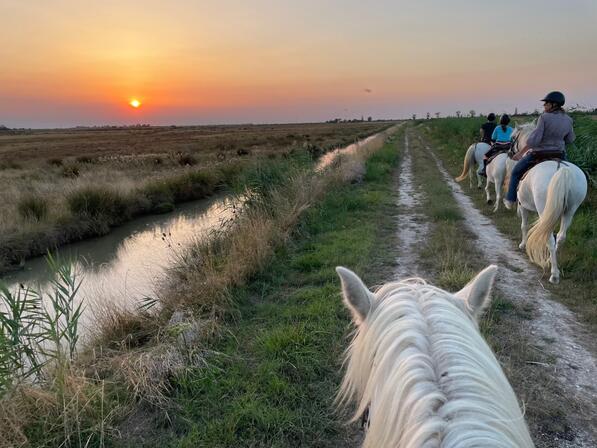
1
La Manade
In a friendly atmosphere, during the day or at sunset, for beginners and experienced riders alike.
A unique experience, adventures and unforgettable moments to share together!
Refreshments available on site.
- 19 meters of difference in height
-
- Start altitude : 4 m
- End altitude : 4 m
- Maximum altitude : 4 m
- Total positive elevation : 19 m
- Total negative elevation : -19 m
- Max positive elevation : 2 m
- Min positive elevation : -2 m
